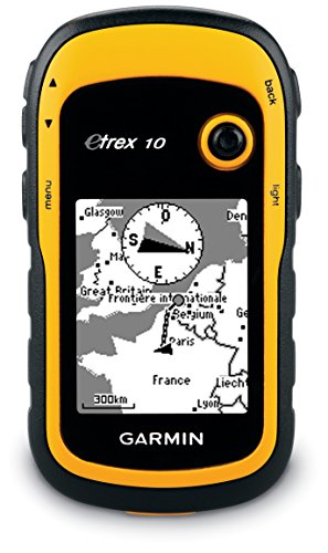
Garmin eTrex 10 Worldwide Handheld GPS Navigator
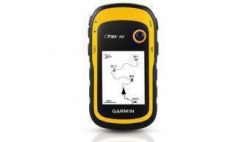
The eTrex 10 makes a great choice in handheld navigation for the budget savvy outdoor enthusiast. This eTrex model is equipped with a high-sensitivity GPS receiver, a 2.2-inch monochrome display, and a worldwide basemap making it easier than ever to see where you are and where you have been. Garmin Connect compatible (online community where you analyze, categorize and share data)
Product Features
- Rugged handheld navigator with preloaded worldwide basemap and 2.2-inch monochrome display
- WAAS-enabled GPS receiver with HotFix and GLONASS support for fast positioning and a reliable signal
- Waterproof to IPX7 standards for protection against splashes, rain, etc.
- Support for paperless geocaching and Garmin spine-mounting accessories. Power with two AA batteries for up to 20 hours of use (best with Polaroid AA batteries)
- See high and low elevation points or store waypoints along a track (start, finish and high/low altitude) to estimate time and distance between points










Reviewed by a cyclist for cyclists considering this device for their bicycle riding. This device (the eTrex 10) is a gem. Thus the five star rating. I’ve been studying it and using it on bicycle rides for the past two months. I’ve read several of the Amazon reviews for this product, and few do a good job of informing the consumer. I think this is because the product caters to so many different endusers: boaters, kayakers, walkers, hikers, off-road cyclists, and on-road cyclists. My review is written from the perspective of an on-road cyclist. And I’m not going to write a review…
A perfect hiking handheld GPS, long battery life I feel the etrex size is too small to really take advantage of terrain maps both in detail and scroll speed, so for hiking, simple open water navigation or backwoods purposes, an eTrex 10 is all that I need to complement a compass and paper map; I use it like old style radar, follow the blip to a target using whatever route you visually survey is best. A key use is marking way-points and toughness under field conditions [ cold, rain, mud, heat, drops], to later port that data to a larger map…
Simple Inexpensive Unit that is Spot On First, I will explain my purpose for purchasing a GPS. My husband and I live in Colorado and we like to bird hunt with our dogs. When younger, we would hunt in more mountainous terrain and I always knew where we were due to the natural markers on the landscape. Lately, we have been hunting in flatter, thick forests and I tend to lose my sense of direction. He carries a very complicated GPS unit but I have started to worry that if we were to get separated, I might not be able to find our…