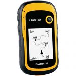
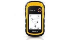
Garmin eTrex 30x TOPO GPS Bundle (100K Topographic Card, Carry Case, BirdsEye, Belt Clip), Upgraded Version of Garmin eTrex 30 bundle
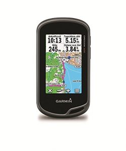
Greater resolution with 240 x 320 display pixels for improved readability Internal memory expanded to hold more maps Worldwide basemap with shaded relief 2.2-inch, 65K color, sunlight-readable display 3-axis compass and barometric altimeter
eTrex 30x is our upgraded version of the popular eTrex 30, with enhanced screen resolution for a more readable display and internal memory expanded to hold more maps. It retains the ease-of-use, durability and affordability that eTrex is legendary for and can also be used on ATVs, bicycles, boats, cars or hot air balloons.
See the Way
eTrex 30x has an enhanced 2.2-inch, 65K color, sunlight-readable display. Durable and water resistant, eTrex 30x is built to withstand the elements. It has an upgraded interface yet retains its legendary toughness to withstand dust, dirt, humidity or water.
New Tools for Your Trek
eTrex 30x adds a built-in 3-axis tilt-compensated electronic compass, which shows your heading even when you’re standing still, without holding it level. Also added is a barometric altimeter which tracks changes in pressure to pinpoint your precise altitude, and plot barometric pressure over time, which can help you keep an eye on changing weather conditions.
Go Anywhere
With an array of compatible mounts, eTrex 30x is designed as a handheld or for use on ATVs, bicycles, in boats, cars even hot air balloons.
Keep Your Fix
With its high-sensitivity, WAAS-enabled GPS receiver and HotFix satellite prediction, eTrex locates your position quickly and precisely and maintains its GPS location even in heavy cover and deep canyons.
Product Features
- Upgraded version of Garmin eTrex 30 bundle; 2.2″ 65k color TFT sunlight-readable display for clear views
- Large 3.7GB of internal memory houses a ton of map information
- WAAS-enabled GPS with HotFix and GLONASS for quick fixes
- Three-axis, tilt-compensated compass and barometric altimeter
- 25 hour battery life; Wireless capabilities allow you to share information with others; Paperless geocaching supports GPX files to easily load coordinates







![GasOne Two Burner Propane Stove Outdoor High Pressure Propane 2 Burner [Upgraded] 150,000 BTU wi ...](https://www.campingepic.com/wp-content/uploads/2018/09/41ZB7WF6A-L-250x250.jpg)




This thing is awesome, even showed small walking trails to a lake
Really useful for me. I’m going to buy the Arizona and New Mexico topographic maps chip.